Latent Heat and You
By Daniel Brouse
You probably think of the water cycle as a simple process:
Evaporation → clouds → rain
But there is something hidden inside that cycle: energy.
Every time water evaporates, enormous amounts of energy move from one place to another. As climate change warms the oceans and atmosphere, this energy-transfer system is becoming more powerful—and you may see the consequences right outside your back door.
The Invisible Energy Transfer
When sunlight warms the ocean, some of that energy becomes heat stored in the water.
But the ocean also has a powerful way to get rid of heat: evaporation.
When a water molecule changes from liquid to vapor, it takes energy with it. That energy is called latent heat.
Approximately:
1 kilogram of evaporated water = about 2.45 megajoules of energy transported into the atmosphere.
That is energy you cannot see.
The water vapor can then travel hundreds or thousands of miles before it condenses into clouds and rain.
When condensation occurs, the stored energy is released back into the atmosphere as heat.
So the basic process is:
Ocean heat → evaporation → water vapor → atmospheric transport → condensation → heat released into the atmosphere
The water cycle is therefore also an energy-transfer system.
Why Does Climate Change Matter?
A warmer planet changes both sides of this process.
Warmer ocean water provides more energy for evaporation.
At the same time, warmer air can contain more water vapor. The Clausius-Clapeyron relationship tells us that the atmosphere’s capacity to hold water vapor increases by roughly 7% for every 1°C (1.8°F) of warming.
That does not mean rainfall increases everywhere by 7%. Weather patterns, circulation, geography, and seasonal conditions still determine where and when rain occurs.
But it does mean that when the atmosphere has access to additional moisture, there is more water—and therefore more latent energy—available to move through the weather system.
Think of the atmosphere as carrying an invisible reservoir of water and stored energy.
As that reservoir grows, some weather events can become more intense.
The Same Energy Can Help Produce Drought AND Flooding
This is where things become especially important.
During a hot, dry period, increased evaporation can pull moisture out of:
Soil → vegetation → lakes → streams
That can accelerate drying.
The sequence can look like:
Heat → increased evaporation → soil moisture loss → stressed vegetation → flash drought → wildfire risk
Then the weather pattern changes.
Moisture that has accumulated over warm oceans can be transported into the region. When that moisture rises and condenses, its stored latent heat is released into the atmosphere.
The sequence can become:
Warm ocean → evaporation → water vapor → moisture transport → rising air → condensation → latent heat release → stronger convection → heavier rainfall
The result can be a rapid transition from extreme dryness to extreme rainfall.
This is one component of what scientists call hydroclimatic whiplash.
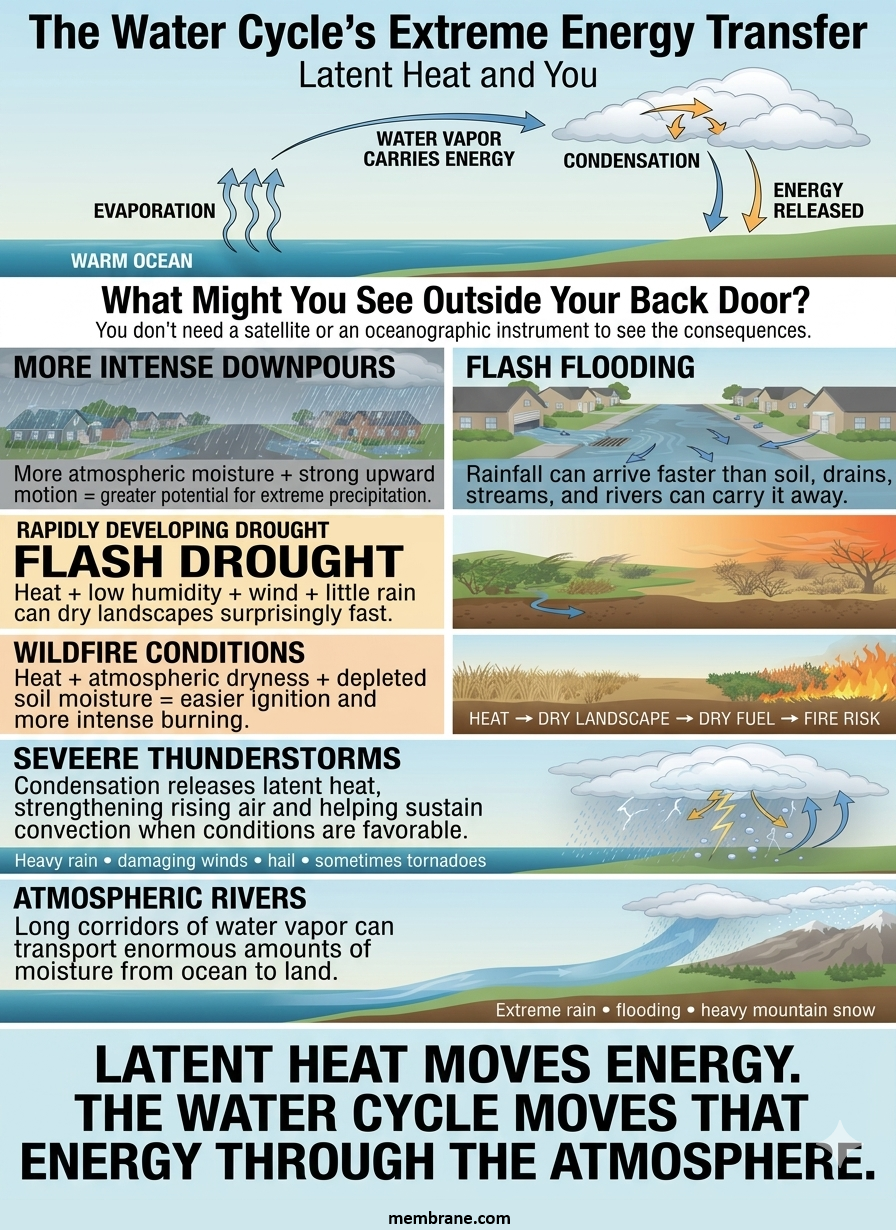
What Might You See Outside Your Back Door?
You don’t need a satellite or an oceanographic instrument to see the consequences.
You may notice:
More intense downpours
Instead of a steady, moderate rain, you may experience rainfall that dumps a large amount of water in a short period.
More atmospheric moisture + strong upward motion = greater potential for extreme precipitation.
Flash flooding
When rainfall arrives faster than soil, storm drains, streams, and rivers can absorb or carry it away, water rapidly accumulates.
A few hours of extreme rainfall can overwhelm systems designed for older precipitation patterns.
Rapidly developing drought
A landscape can dry surprisingly quickly when high temperatures combine with low humidity, wind, and a lack of rainfall.
This can produce flash droughts that develop much faster than traditional droughts.
Wildfire conditions
Dry vegetation becomes fuel.
Heat + atmospheric dryness + depleted soil moisture can create landscapes that ignite more easily and burn more intensely.
Severe thunderstorms
Condensation releases latent heat into storm clouds. That energy can strengthen rising air and help sustain convection when other atmospheric conditions are favorable.
The result can include stronger thunderstorms, torrential rain, damaging winds, hail, and sometimes tornadoes.
Atmospheric rivers
Long corridors of moisture can transport enormous quantities of water vapor from the ocean toward land.
When those moisture streams encounter favorable atmospheric conditions, they can produce extreme rainfall, flooding, and—in mountainous regions—heavy snowfall.
The Climate Change Connection
The important point is not that climate change “causes every storm.”
It doesn’t.
Weather is still controlled by many interacting factors, including atmospheric pressure, temperature gradients, moisture gradients, winds, fronts, topography, and natural climate variability.
Climate change changes the background conditions in which those weather systems operate.
A warmer atmosphere can hold more moisture.
A warmer ocean can provide more moisture through evaporation.
A warmer climate can increase evaporative demand over land.
And when abundant moisture eventually condenses, the release of latent heat can add energy to developing storms.
The result is a climate system with the potential for more extreme swings:
Heat → drying → drought → wildfire
followed by:
Moisture transport → intense rainfall → flooding → erosion
And sometimes the cycle can repeat.
The Hidden Energy in a Raindrop
The next time you watch a heavy rainstorm from your back door, consider what you are actually seeing.
That rain began as water somewhere else—often over an ocean.
Energy from the Earth’s climate system helped evaporate it.
Atmospheric circulation transported it.
The water vapor eventually rose, cooled, and condensed.
And when it condensed, the energy stored during evaporation was released into the atmosphere.
What looks like “just rain” is actually the final visible stage of a massive planetary energy-transfer process.
The water cycle moves water.
The latent heat cycle moves energy.
And climate change is altering both.
The Bottom Line
The most important idea is simple:
Warm oceans → more evaporation → more atmospheric moisture → more latent energy available to weather systems.
At the same time:
Hotter land → greater evaporative demand → faster drying → greater drought and wildfire risk.
Those two pathways can collide when atmospheric circulation transports moisture into a region that has just experienced prolonged heat and dryness.
That is the essence of hydroclimatic whiplash:
Drought can be followed by flooding.
Wildfire conditions can be followed by extreme rainfall.
A warming climate can produce both more intense drying and more intense precipitation.
The water cycle is not just about where the water goes.
It is about where the energy goes.
And as the planet warms, understanding that hidden energy transfer is increasingly important to understanding the extreme weather we can see right outside our own back doors.