by Daniel Brouse
Indiana and New York: When 1-in-1,000-Year Rain Becomes a Real-World Risk
The Changing Meaning of “Rare”
A “500-year flood” does not mean a flood that occurs only once every 500 years. It describes an event with an estimated 0.2% chance of occurring in any given year, based on historical and statistical assumptions.
The problem is that those assumptions can become outdated as climate conditions change.
Rainfall and flooding once considered extraordinarily rare are occurring more frequently in many regions. Events that infrastructure and communities were designed to withstand only once in a century—or once in several centuries—are increasingly being challenged by rainfall extremes outside the historical range.
The summer of 2026 provides another striking example.
Indiana: Record Rainfall and a Record White River
In August 2026, central and east-central Indiana experienced a prolonged period of severe weather and extreme rainfall. A powerful derecho moved through the region on August 11, producing destructive winds, hail, and tornadoes. The storm was followed by repeated rounds of heavy thunderstorms that moved over already saturated ground.
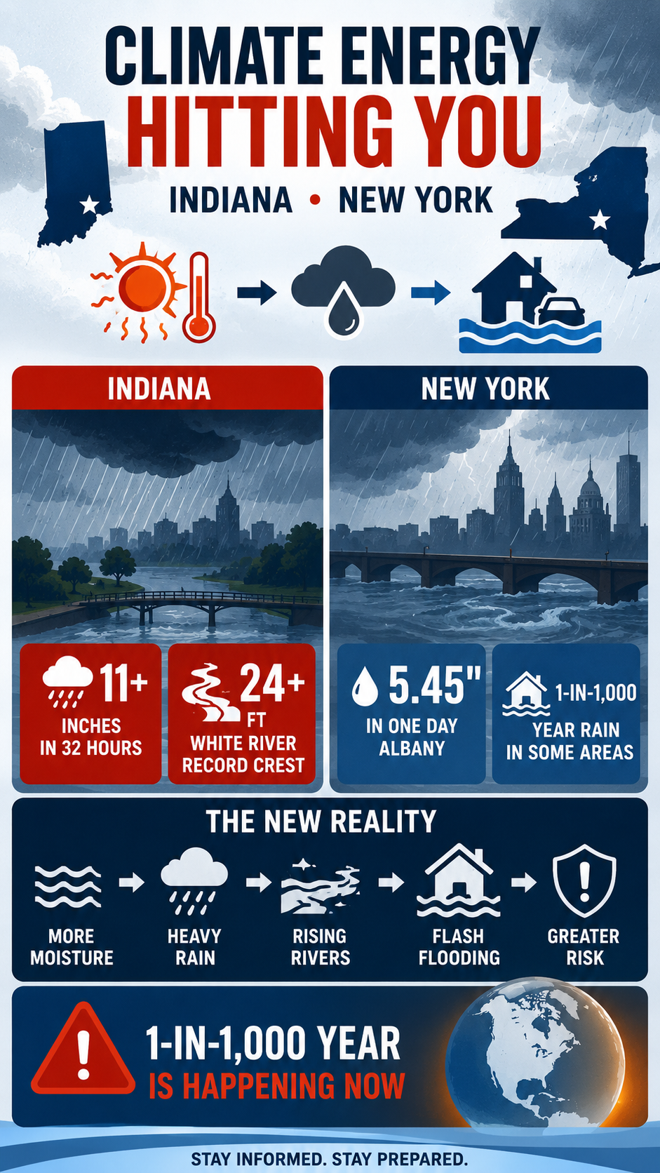
The National Weather Service reported more than 11 inches of rain in some parts of central Indiana. New Castle recorded 11.24 inches at one observing site, while a location near New Lisbon recorded 11.50 inches over two days.
The result was catastrophic flooding.
The White River reached record levels at multiple locations. At Anderson, the river crested at 24.93 feet on August 14, breaking the previous record of 23.60 feet set during the Great Flood of 1913. At Noblesville, the river reached 24.60 feet on August 15, also breaking the 1913 record of 23.80 feet.
Roads were washed out, homes and businesses were flooded, and numerous water rescues were required. Indiana Governor Mike Braun declared a statewide disaster emergency and mobilized the Indiana National Guard.
The event was not simply a single downpour. A derecho was followed by repeated thunderstorms and persistent atmospheric moisture, allowing rainfall to accumulate over the same watersheds for several days. The National Weather Service described the resulting flooding in portions of central Indiana as catastrophic.
The Indiana Event
| Location | 2026 Extreme | Consequence |
|---|---|---|
| New Castle / Henry County | More than 11 inches in roughly two days | Severe flash flooding |
| Anderson | White River crest: 24.93 feet | New record, surpassing 1913 |
| Noblesville | White River crest: 24.60 feet | New record, surpassing 1913 |
| Central and east-central Indiana | Multiple rounds of heavy rainfall | Washed-out roads, rescues, property damage |
The significance is not simply that a rainfall record was broken. The larger concern is the interaction between extreme rainfall, saturated soils, repeated storms, and river response.
Once the ground is saturated, additional rainfall increasingly becomes runoff. That runoff rapidly enters streams and rivers, turning an extreme rainfall event into an extreme flood.
New York: Another 1-in-1,000-Year Rainfall Event
Indiana was not alone.
From July 28–30, eastern New York experienced an extraordinary heavy-rain event. The National Weather Service reported widespread rainfall totals of 6 to 12 inches, with localized amounts exceeding 11 inches. Rainfall rates reached 1 to 3 inches per hour, while thunderstorms repeatedly moved over the same areas.
At Albany, 5.45 inches of rain fell on July 29, shattering the previous daily record of 1.90 inches set in 1974. It was the wettest July day in Albany’s recorded history and the second-wettest calendar day overall.
More importantly, the National Weather Service classified rainfall in parts of eastern New York as a 1-in-1,000-year precipitation event. Schodack recorded 11.79 inches, while Kinderhook received 11.47 inches.
The New York Event
| Location | 2026 Extreme | Consequence |
| Albany | 5.45 inches in one day | All-time July daily rainfall record |
| Schodack | 11.79 inches | 1-in-1,000-year precipitation event |
| Kinderhook | 11.47 inches | 1-in-1,000-year precipitation event |
| Eastern New York | 6–12 inches widespread | Major flash flooding |
This distinction matters: Albany’s 5.45-inch rainfall was a record, while the 1-in-1,000-year classification applied to portions of the broader eastern New York event.
The Pattern Is Bigger Than a Single Storm
Both Indiana and New York illustrate an important feature of a warming climate: more atmospheric moisture can amplify the intensity of extreme precipitation.
A warmer atmosphere can hold more water vapor—roughly 7% more for every 1°C of warming under the Clausius-Clapeyron relationship.
That does not mean every storm produces 7% more rain. But when atmospheric conditions concentrate and release that additional moisture, rainfall rates can become extreme.
The consequences can compound:
More atmospheric moisture
↓
Higher potential rainfall rates
↓
Repeated heavy thunderstorms
↓
Saturated soils
↓
Rapid runoff
↓
Flash flooding and river flooding
↓
Infrastructure failure and displacement
This is one mechanism through which climate energy becomes a direct physical hazard.
Indiana and New York: From Heat to Flood
The same atmospheric system that stores additional heat and moisture can contribute to seemingly contradictory extremes.
A persistent ridge or heat dome can produce oppressive heat and increase atmospheric moisture demand. When the weather pattern breaks—or when a front, upper-level disturbance, or convective system provides the mechanism for release—the accumulated moisture can produce intense rainfall.
This creates what can be described as hydroclimatic whiplash:
Heat → moisture accumulation → atmospheric instability → extreme rainfall → flooding → rapid transition to another extreme
The sequence is not necessarily a simple one-to-one causal chain. Weather systems remain complex, and individual floods cannot automatically be attributed to climate change without event-specific attribution analysis.
But the physical ingredients are becoming increasingly important: warmer air, greater atmospheric moisture, intense precipitation, saturated soils, and infrastructure designed around historical climate statistics.
New York’s August Severe Weather
The pattern continued into August.
On August 20, severe storms struck the New York metropolitan region and Long Island. A waterspout moved onshore at Atlantic Beach and became a tornado, damaging beach-club structures. Severe flooding also affected Queens and other parts of the region, while emergency responders rescued people from flooded vehicles.
These events occurred within the same summer that eastern New York had already experienced its extraordinary July rainfall.
That is important because climate risk is not simply about isolated record events. Repeated extremes can compound damage.
A community does not have to experience a 1-in-1,000-year event every year to experience a radically different risk environment. A sequence of less-extreme events can saturate soils, overwhelm drainage systems, damage infrastructure, and leave communities increasingly vulnerable when the next storm arrives.
Climate Energy Hitting the Ground
Indiana and New York demonstrate two sides of the same problem.
The atmosphere is not merely becoming warmer. A warmer atmosphere can interact with the water cycle, storm dynamics, soil moisture, rivers, infrastructure, and ecosystems in ways that amplify consequences.
The important question is therefore not simply:
“How often does a 1-in-1,000-year event occur?”
It is:
“What happens when the climate that produced our historical risk statistics is no longer the climate we are living in?”
A 1-in-1,000-year rainfall event is supposed to be extraordinarily rare.
When multiple regions begin experiencing events classified at that level, the lesson is not that every “1-in-1,000-year” event has suddenly become a once-per-year event.
The lesson is that the baseline is changing—and the consequences of that change are already reaching communities, rivers, roads, homes, farms, and public infrastructure.
That is climate energy hitting you where you live.