by Daniel Brouse and Sidd Mukherjee
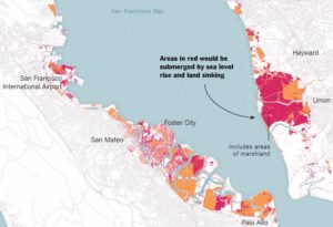
Coastal communities are being forced to adapt to rising sea levels; however, San Francisco has an even bigger problem — sinking land. In a report published in Science Advances (07 Mar 2018: Vol. 4, no. 3, eaap9234 / DOI: 10.1126/sciadv.aap9234), the Bay Area has to face both rising sea levels and sinking land.
The report indicates that the sinking land (called land subsidence) will increase the reach and damage of flooding in the Bay Area. The impact will be more dramatic than predicted in the forecasts for 2100.
“It’s a very well-known problem, but we really don’t know how fast it’s going to be in the second half of the 21st century. This is a projection,” Dr. Shirzaei said.
Abstract
by Manoochehr Shirzaei and Roland Bürgmann
The current global projections of future sea level rise are the basis for developing inundation hazard maps. However, contributions from spatially variable coastal subsidence have generally not been considered in these projections. We use synthetic aperture radar interferometric measurements and global navigation satellite system data to show subsidence rates of less than 2 mm/year along most of the coastal areas along San Francisco Bay. However, rates exceed 10 mm/year in some areas underlain by compacting artificial landfill and Holocene mud deposits. The maps estimating 100-year inundation hazards solely based on the projection of sea level rise from various emission scenarios underestimate the area at risk of flooding by 3.7 to 90.9%, compared with revised maps that account for the contribution of local land subsidence. Given ongoing land subsidence, we project that an area of 125 to 429 km2 will be vulnerable to inundation, as opposed to 51 to 413 km2 considering sea level rise alone.
The flood risks across the whole USA are seriously underestimated
The following paper covers all flood risk, not just the coasts, but inland and all the causes including sea level rise as well as flooding rivers and large precipitation events outside watersheds.
doi: 10.1088/1748-9326/aaac65
http://iopscience.iop.org/
“Estimates of present and future flood risk in the conterminous United States”
Oliver E J Wing , Paul D Bates, Andrew M Smith, Christopher C Sampson, Kris A Johnson, Joseph Fargione and Philip Morefield
Environ. Res. Lett. 13 (2018) 034023
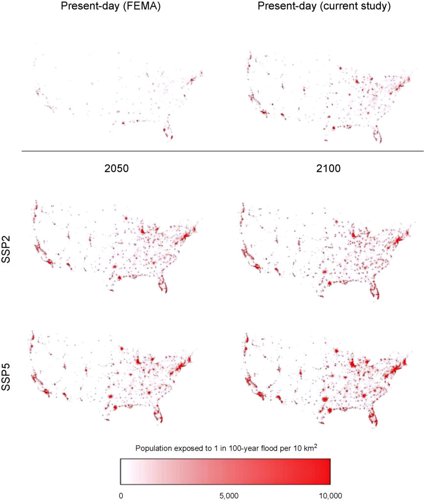
Wing et al. analyze flood risk in the US lower 48. Apparently 41 million are at risk rather than 13 million in current FEMA estimates.
WARNING: this paper specifically does not cover sea levels rise and increased precipitation.
“Our data show that the total US population exposed to serious flooding is 2.6–3.1 times higher than previous estimates, and that nearly 41 million Americans live within the 1% annual exceedance probability floodplain (compared to only 13 million when calculated using FEMA flood maps)”
“The analysis shows that 40.8 million people (13.3% of the population) are currently exposed to a 1 in 100 year (1% annual exceedance probability) fluvial or pluvial flood in the CONUS, which translates to a GDP exposure of $2.9 trillion (15.3% of total GDP)”
“This analysis indicates that previous estimates capture roughly one-third of the exposure identified in our 1 in 100 year floodplain.”
“It doesn’t take into account sea level rise and heavier rainfall expected to come along with climate change, so it likely underestimates the exposure, the authors warned.”
https://www.houstonchronicle.com/news/houston-texas/houston/amp/28-million-Americans-live-in-flood-zones-and-12732279.php
Part of the study Who Pays For Flood Insurance?

