by Daniel Brouse
Philadelphia to Washington: Severe Storms, an Expanding “Tornado Alley,” Straight-Line Winds, and the Urban Heat Island
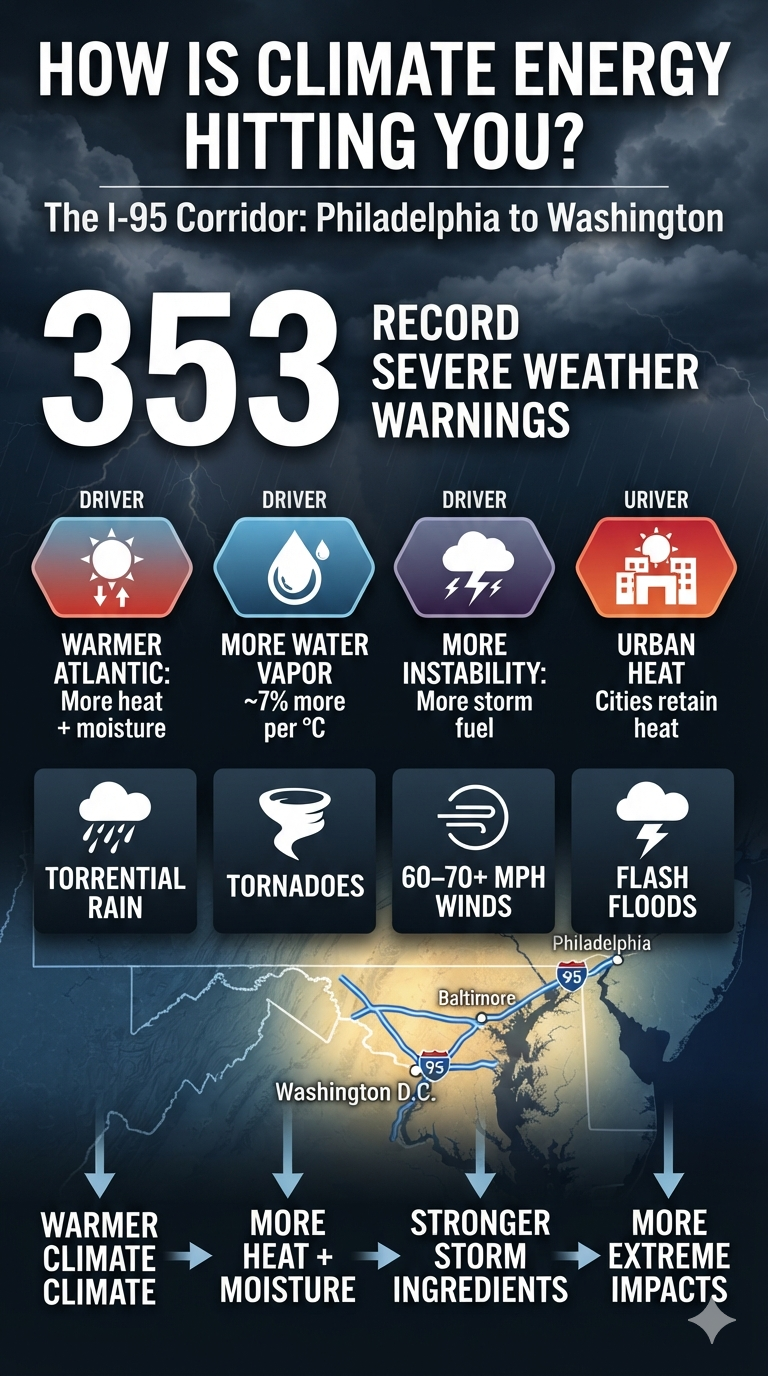
The Philadelphia-to-Washington corridor has experienced an extraordinary number of severe thunderstorm and tornado warnings this year. So far, 353 warnings have been issued across the region, putting the I-95 corridor from Washington, D.C., through Baltimore and Philadelphia at the center of an unusually active severe-weather season.
This concentration of warnings is not the result of a single cause. It reflects the interaction of a warming climate with the atmospheric conditions that generate severe thunderstorms: more available moisture, greater atmospheric instability, strong wind shear, warmer land and ocean surfaces, and increasingly favorable conditions for rapidly developing storms.
An Expanding “Tornado Alley”
The traditional image of “Tornado Alley” centers on the Great Plains. But severe-weather climatology is not static. Over recent decades, the eastern United States has experienced a growing share of tornado and severe-convective activity, with the Mid-Atlantic increasingly exposed to damaging storms.
The Washington-to-Philadelphia corridor is particularly vulnerable because of its geography. Warm, moisture-rich air from the Atlantic Ocean and the Gulf Stream can surge northward and collide with cooler, drier air and frontal boundaries moving eastward across the Appalachians.
When those ingredients overlap with sufficient wind shear and atmospheric instability, the result can be rapidly developing thunderstorms capable of producing tornadoes, damaging winds, large hail, and torrential rainfall.
A Warmer Atmosphere Means More Atmospheric Fuel
One of the most important climate connections is atmospheric moisture.
For every 1°C of warming, the atmosphere can hold approximately 7% more water vapor. A warmer atmosphere does not automatically produce severe weather, but when moisture is available and the other ingredients for convection are present, that additional moisture provides more energy and water for intense storms.
Along the heavily urbanized Northeast corridor, this can produce extremely high rainfall rates. Downpours capable of dropping several inches of rain in a short period can overwhelm drainage systems and produce flash flooding with little warning.
The same moisture-rich environment can also contribute to stronger thunderstorms by increasing the amount of latent heat released as water vapor condenses within developing storm clouds.
Microbursts and Damaging Straight-Line Winds
Not every destructive wind event is a tornado.
Many severe thunderstorm warnings along the I-95 corridor involve straight-line winds, downbursts, and microbursts. These winds can reach 60–70 mph or more and can cause damage comparable to that produced by weaker tornadoes.
A microburst occurs when a powerful column of descending air reaches the surface and spreads outward rapidly. The resulting winds can knock down trees and power lines, damage structures, overturn vehicles, and create dangerous conditions for aviation.
The distinction matters because the damage may look similar to tornado damage even when no tornado occurred.
The Urban Heat Island Adds Another Layer
Philadelphia, Baltimore, and Washington, D.C., are enormous concentrations of concrete, asphalt, buildings, vehicles, and other heat-absorbing surfaces.
These urban areas create a heat-island effect, in which temperatures remain higher than in surrounding rural areas, particularly after sunset. During the day, intense solar heating can further warm the surface and the air immediately above it.
When this heat interacts with an already warm, humid atmosphere, it can increase atmospheric instability. Boundaries created by differences between urban and rural heating can also help influence where thunderstorms develop or intensify.
That does not mean the urban heat island “causes” every severe storm. Rather, it is another component of an increasingly complex environment in which multiple sources of atmospheric energy can interact.
Climate Energy Meets Weather
The critical point is that climate change does not replace ordinary weather dynamics. It changes the background conditions in which those dynamics operate.
A warming Atlantic provides additional heat and moisture. A warmer atmosphere increases moisture capacity. Warmer urban surfaces add localized heat. Strong frontal boundaries and wind shear provide the structure needed for severe convection.
When these ingredients come together, the result can be a rapidly escalating sequence:
Warmer ocean → more atmospheric moisture → greater latent heat → greater instability → stronger convection → intense rainfall, downbursts, straight-line winds, and tornadoes.
The result is not simply “more storms.” It is an atmosphere increasingly capable of producing higher-impact extremes when the right ingredients align.
For the Philadelphia-to-Washington corridor, the extraordinary number of severe-weather warnings this year is another reminder that climate energy is not an abstract measurement on a graph. It is expressed through the atmosphere above our cities—and increasingly through the storms moving across them.
353 warnings is not just a number. It is a measure of how often the atmosphere has been reaching the threshold for potentially dangerous weather.