by Daniel Brouse
El Niño, Atlantic Niña, Teleconnections, and a Real-Time Climate Experiment on the Jersey Shore
Tonight’s “homework” is to observe one of the most fascinating manifestations of chaos theory in real time: climate teleconnections.
And, of course, it has a lot to do with the Butterfly Effect.
The question is simple:
What happens to atmospheric and oceanic energy when the climate system changes the pathway through which that energy is normally expressed?
Climate change and coastal impacts are becoming increasingly serious problems along the Southern Jersey Shore, where barrier-island communities are particularly exposed. At the same time, federal funding for beach nourishment has become more constrained, while the sand required to maintain vulnerable beaches is itself becoming an increasingly limited resource.
The next several days should provide an interesting real-world experiment.
The Jersey Shore experiment
A powerful September nor’easter is affecting the Jersey Shore, bringing coastal flooding, dangerous surf, strong northeast winds, and significant beach erosion. The National Weather Service has issued a Coastal Flood Warning for Ocean, Atlantic, Cape May, and southeastern Burlington counties through early Saturday. The warning calls for one to two feet of inundation in vulnerable low-lying areas, with widespread roadway flooding possible.
Along portions of the coast, the National Weather Service is also warning of high surf, with breaking waves reaching approximately nine feet in the surf zone.
The timing is important. The storm is occurring near the full-moon period, when astronomical tides can increase the baseline water level and make coastal flooding more consequential.
So here is the experiment:
Watch what happens along the coast—and ask where the energy is being expressed.
The missing hurricanes
The alarming part isn’t simply that Atlantic hurricane activity has been unusually limited.
It is the possibility that multiple components of the climate system are becoming more strongly coupled.
I first raised the possibility of an unusual Pacific El Niño–Atlantic Niña interaction earlier this year. Now, as we move deeper into the Atlantic hurricane season, the observations provide an opportunity to examine how a disturbance in one ocean basin can influence atmospheric circulation and weather thousands of miles away.
NOAA’s September 2026 ENSO diagnostic reports that El Niño is strengthening, with sea-surface-temperature anomalies exceeding +3°C in the eastern equatorial Pacific. NOAA also gives greater than a 90% probability of a very strong El Niño during the Northern Hemisphere fall and winter of 2026–27.
That matters because El Niño is not confined to the Pacific.
Changes in tropical Pacific convection and atmospheric circulation can generate teleconnections—large-scale atmospheric responses that extend far beyond the region where the original oceanic anomaly developed.
NOAA’s hurricane researchers have specifically identified strong El Niño conditions as a factor that can suppress Atlantic hurricane development by increasing vertical wind shear, making it more difficult for tropical systems to organize and intensify.
So where does the energy go?
This is the question I want to explore.
The climate system does not simply make energy disappear because one particular type of weather event becomes less favorable.
Energy is redistributed.
A strong Pacific El Niño alters tropical convection and atmospheric circulation. Those changes can propagate through the atmosphere and influence weather patterns across distant ocean basins and continents.
At the same time, the Atlantic is experiencing its own unusual state.
The result is not necessarily a simple substitution of “hurricanes” with “nor’easters.” Weather systems have different physical mechanisms and energy sources. But the broader climate-system question remains:
When the pathways through which energy is normally released or transported are altered, what happens to the rest of the system?
That is the essence of a teleconnection.
From the Pacific to the Atlantic
This is where the experiment becomes especially interesting.
We are watching an exceptionally strong Pacific El Niño develop while the Atlantic is exhibiting anomalous conditions of its own.
The Pacific disturbance can influence the atmosphere far beyond the Pacific basin. Those atmospheric changes can affect wind patterns, pressure fields, storm tracks, ocean circulation, and the conditions governing tropical cyclone development.
In other words:
Pacific ocean → atmosphere → Atlantic circulation → storm environment → coastal weather
That is a teleconnection.
And when several components of the system interact simultaneously, the result can become much more complicated than any individual phenomenon viewed in isolation.
Chaos theory in the real world
This is where the Butterfly Effect becomes more than a metaphor.
Chaos theory does not mean that every weather event is unpredictable or that a butterfly literally causes a hurricane.
It means that a nonlinear system can contain strong interactions in which relatively small changes in one part of the system can influence the evolution of other parts of the system.
The climate system is enormously more complicated than the classic butterfly metaphor.
It contains interacting oceans, atmosphere, ice, clouds, water vapor, ecosystems, and circulation systems.
And those components are connected.
A disturbance thousands of miles away can therefore become relevant to what happens on a New Jersey beach.
The coastal consequence
For people living along the Jersey Shore, the abstract physics eventually becomes very concrete.
It becomes:
higher water → stronger waves → beach erosion → coastal flooding → damaged infrastructure
The current National Weather Service warning illustrates that vulnerability. One to two feet of inundation is enough to produce widespread roadway flooding in vulnerable coastal and bayside communities, with some roads becoming impassable.
That is why this is more than an interesting atmospheric experiment.
The Jersey Shore is an enormous natural laboratory for observing how changes in the global climate system eventually reach local communities.
Look out the window
So tonight’s homework is simple.
Look outside.
Watch the wind.
Watch the waves.
Watch the water.
Look at what is happening along the beaches from New Jersey to North Carolina.
Then ask:
Where did the hurricane energy go?
Perhaps the more scientifically useful question is:
How is the climate system redistributing energy when one of its traditional pathways is disrupted?
That is the experiment.
And that is the Butterfly Effect in the real world:
A disturbance in one part of the climate system can produce consequences thousands of miles away—not because the system is random, but because it is deeply connected.
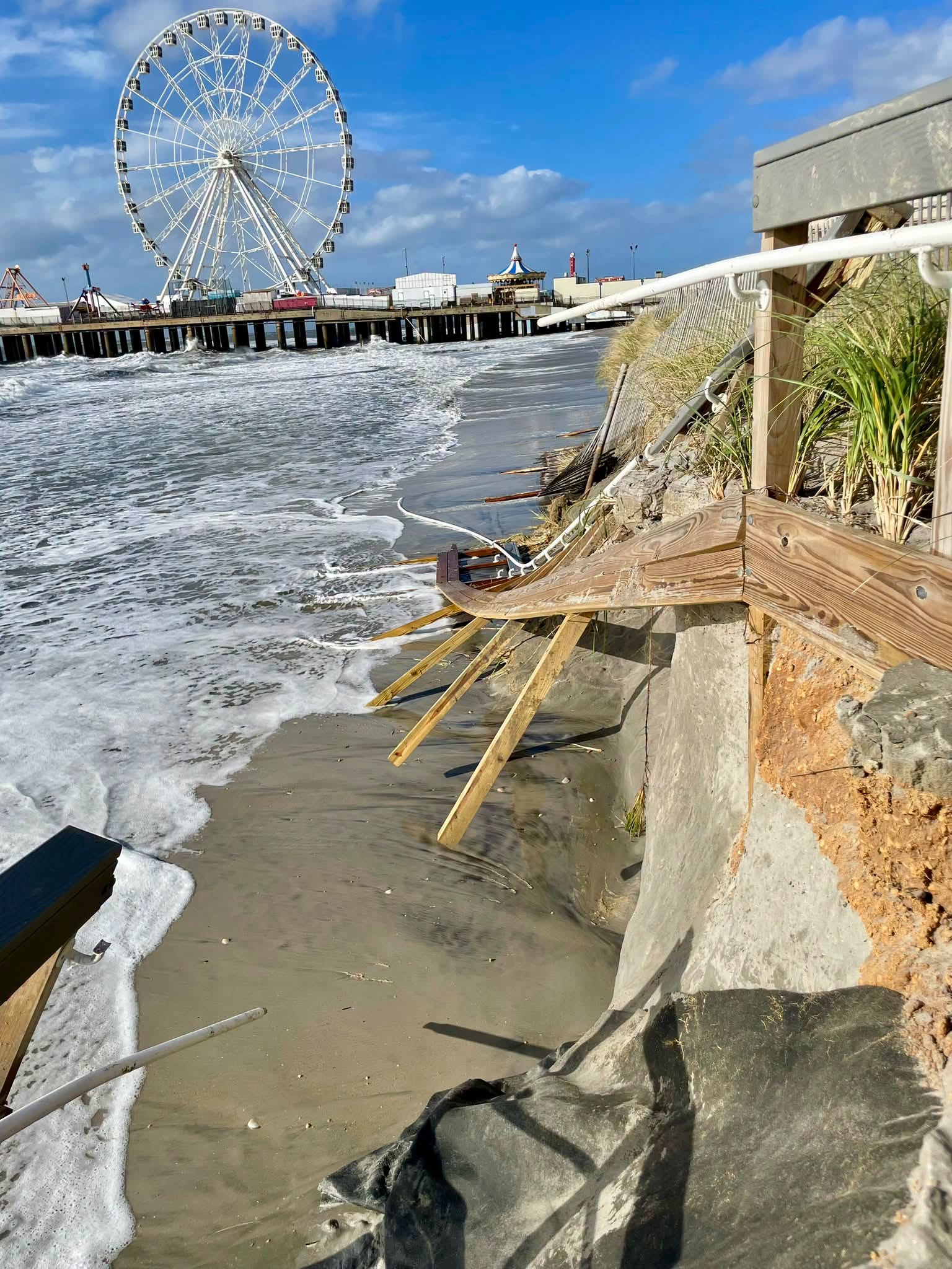
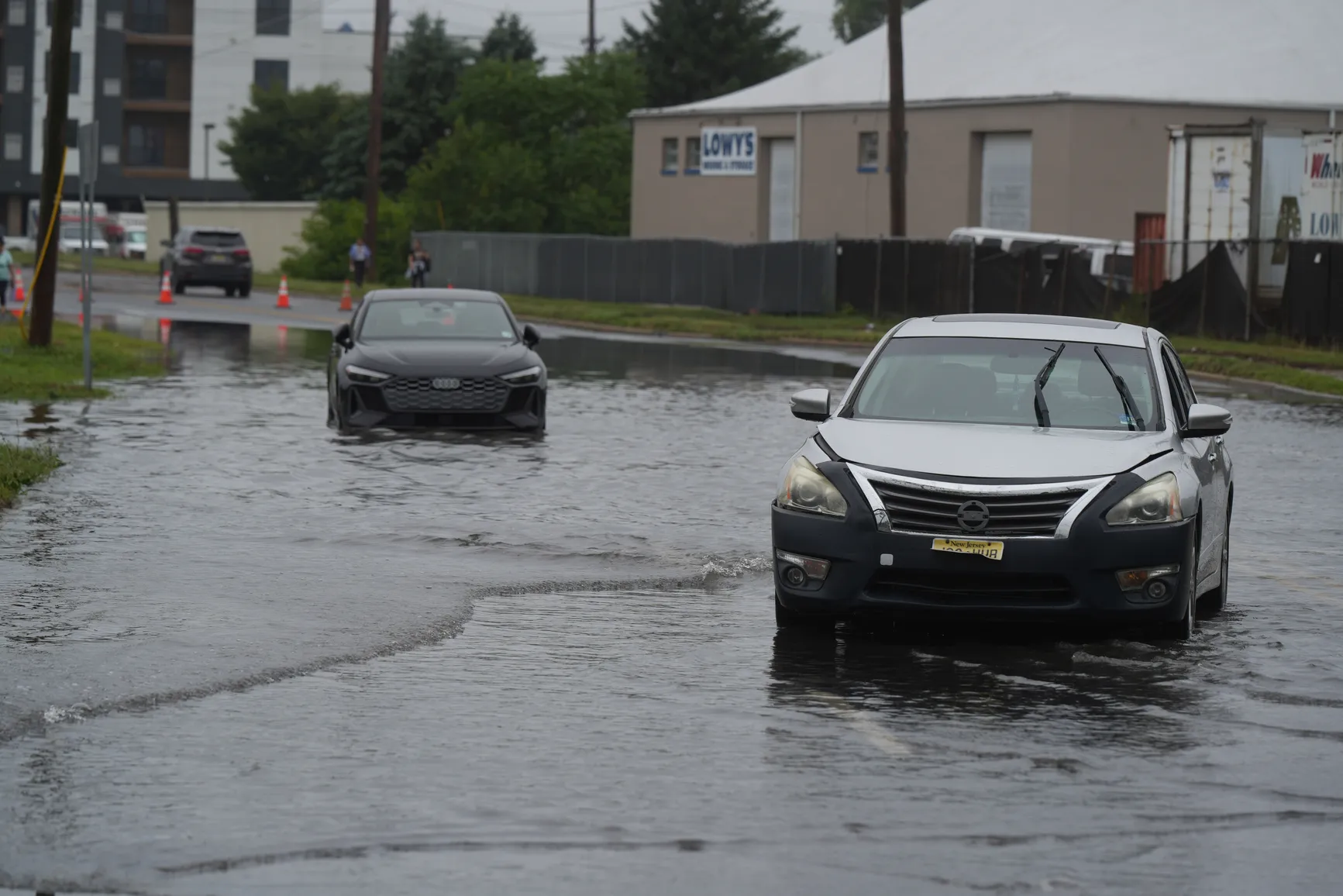
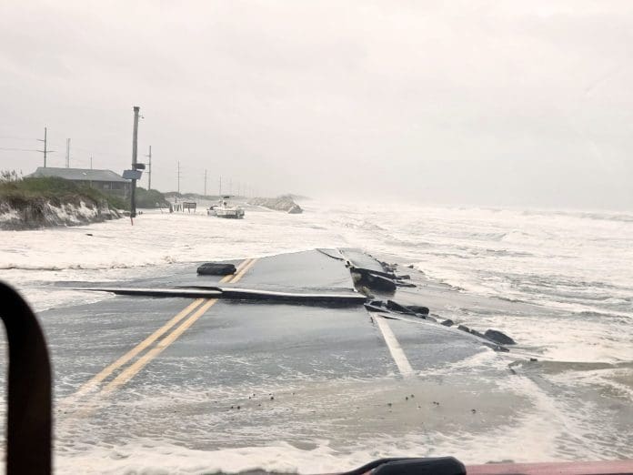
Following are photographs from New Jersey to North Carolina.
Look closely.
The climate system is telling us a story.
We just have to learn how to read it.
Simplified Social Media Version
🌪️ WHERE DID THE HURRICANE ENERGY GO?
Tonight’s homework experiment: watch the Jersey Shore.
A powerful September nor’easter is hitting the coast while an unusually strong Pacific El Niño is reshaping atmospheric circulation thousands of miles away.
At the same time, Atlantic hurricane activity has been unusually limited.
So here’s the question:
❓ When one pathway for releasing and redistributing climate-system energy is disrupted, where does that energy go?
This is where 🌎 teleconnections, nonlinear climate dynamics, and the 🦋 Butterfly Effect become visible in the real world.
🌊 Pacific Ocean
↓
🌬️ Atmosphere
↓
🌎 Atlantic circulation
↓
🌪️ Storm environment
↓
🏖️ Coastal impacts
Look out your window.
Watch the wind, waves, tides, and flooding.
Then ask:
❓ Is this just another storm—or are we watching the climate system redistribute energy across a deeply interconnected planet?
📸 Following the storm from New Jersey to North Carolina.