by Daniel Brouse
As Earth’s climate warms, meteorologists and climate scientists are increasingly relying on specialized terminology to describe weather events that were once considered rare but are now becoming more frequent and more intense. Rising global temperatures have added energy to the atmosphere, while changes in the jet stream have altered weather patterns across much of the world. As a result, many scientific terms have moved from research journals into everyday weather forecasts.
Understanding these terms provides insight into how climate change is reshaping the atmosphere and why weather is becoming more extreme.
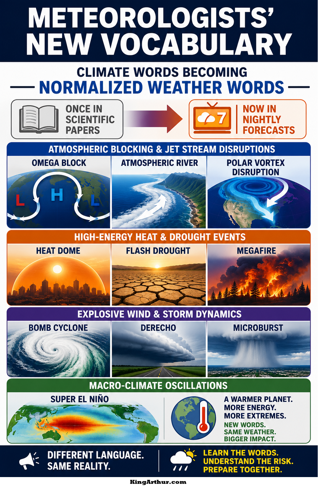
Atmospheric Blocking and Jet Stream Disruptions
Omega Block
An Omega Block is a large, persistent high-pressure system positioned between two low-pressure systems, creating a pattern that resembles the Greek letter Ω. These blocking patterns can remain nearly stationary for days or even weeks, preventing normal weather systems from moving. The result is prolonged heatwaves beneath the high-pressure ridge while neighboring regions experience extended periods of heavy rain, flooding, or severe storms.
Atmospheric River
An Atmospheric River is a long, narrow corridor of highly concentrated water vapor that can stretch for thousands of miles across the ocean. Often called “rivers in the sky,” these systems transport enormous quantities of moisture ahead of approaching storms. When atmospheric rivers encounter mountain ranges or cooler air masses, they release intense rainfall or snowfall, frequently causing catastrophic flooding, mudslides, and landslides.
Polar Vortex Disruption
The Polar Vortex is a band of powerful winds that normally circles the Arctic, keeping frigid air confined near the North Pole. As Arctic warming weakens this circulation, the vortex can become distorted or displaced, allowing bitterly cold Arctic air to surge southward into North America, Europe, or Asia. These outbreaks can produce severe winter storms and prolonged cold waves despite the long-term warming of the global climate.
High-Energy Heat and Drought Events
Heat Dome
A Heat Dome develops when a strong, persistent ridge of high pressure traps hot air beneath it like a lid on a pot. The sinking air compresses and warms while preventing cooler air from entering the region. As the event persists, soils dry, vegetation becomes stressed, and temperatures climb far above seasonal averages, often producing dangerous heatwaves and worsening wildfire conditions.
Flash Drought
Unlike traditional droughts that develop gradually over months, a Flash Drought can emerge within only a few weeks. Extreme heat, low humidity, persistent sunshine, and strong winds rapidly remove moisture from soils and vegetation. Agriculture can suffer severe losses before many communities even recognize that drought conditions have developed.
Megafire
A Megafire is an exceptionally large and intense wildfire, typically exceeding 100,000 acres. These fires generate enormous amounts of heat, allowing them to create their own localized weather. Towering smoke columns can produce pyrocumulonimbus clouds, generating lightning, powerful winds, and erratic fire behavior that makes suppression extremely difficult.
Explosive Wind and Storm Dynamics
Bomb Cyclone (Bombogenesis)
A Bomb Cyclone, or Bombogenesis, occurs when the central pressure of a mid-latitude storm drops by at least 24 millibars within 24 hours. This rapid intensification dramatically increases the storm’s energy, often producing hurricane-force winds, heavy snowfall, coastal flooding, and blizzard conditions.
Derecho
A Derecho is a widespread, long-lived windstorm associated with a fast-moving line of severe thunderstorms. To qualify as a derecho, damaging straight-line winds of at least 58 miles per hour must extend continuously for more than 400 miles. Although they lack the rotating circulation of tornadoes, derechos can produce destruction over areas much larger than many hurricanes.
Microburst
A Microburst is an intense column of sinking air that descends rapidly from a thunderstorm before striking the ground and spreading outward in all directions. Wind speeds can exceed those found in many tornadoes, causing extensive damage to buildings, forests, aircraft, and electrical infrastructure despite affecting a relatively small area.
Large-Scale Climate Oscillations
Super El Niño
A Super El Niño represents an exceptionally strong phase of the El Niño–Southern Oscillation (ENSO). During these events, unusually warm ocean water spreads across the central and eastern tropical Pacific, releasing vast amounts of heat and moisture into the atmosphere. The additional energy alters global circulation patterns, increasing the likelihood of record-breaking temperatures, extreme rainfall, severe droughts, and compound weather disasters across multiple continents.
A New Climate, A New Language
Not long ago, many of these terms appeared primarily in scientific journals or university textbooks. Today they are routinely used in television weather reports because the atmosphere is producing these events with increasing frequency and intensity.
The expanding vocabulary of modern meteorology reflects more than advances in science—it reflects a changing climate. As greenhouse gases continue to warm the planet, the atmosphere stores more heat and moisture, providing additional energy for weather systems. The result is a world where once-unusual phenomena are becoming familiar features of daily forecasts.
Learning this new language helps us better understand the physical processes driving today’s extreme weather and prepares us for the increasingly energetic climate of the future.
Other Climate and Extreme Weather Terms You Will Hear More Often
As extreme weather becomes more common, meteorologists continue to introduce terms that describe increasingly complex atmospheric and oceanic conditions. While not every term requires a detailed explanation, many have become part of the modern vocabulary of weather forecasting. These include:
- Air Mass Thunderstorm
- Atmospheric Instability
- Back-Building Thunderstorms
- Blizzard Warning
- Cold-Air Outbreak
- Compound Extreme Event
- Convective Available Potential Energy (CAPE)
- Convective Complex (MCS)
- Dry Lightning
- Dust Storm
- Enhanced Risk
- Extreme Heat Warning
- Fire Weather Warning
- Fire Whirl (Fire Tornado)
- Flash Flood Emergency
- Flood Watch
- Freeze-Thaw Cycle
- Fujita (EF) Scale
- Graupel
- Haboob
- Heat Advisory
- Heat Burst
- Heat Index
- Hurricane Rapid Intensification
- Ice Storm Warning
- Lake-Effect Snow
- La Niña
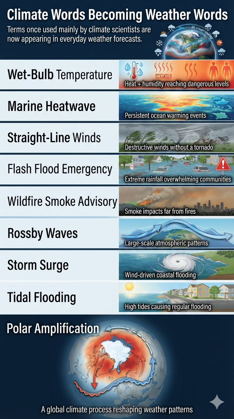
- Marine Heatwave
- Mesocyclone
- Mesoscale Convective System (MCS)
- Nor’easter
- Outflow Boundary
- Permafrost Thaw
- Pluvial Flooding
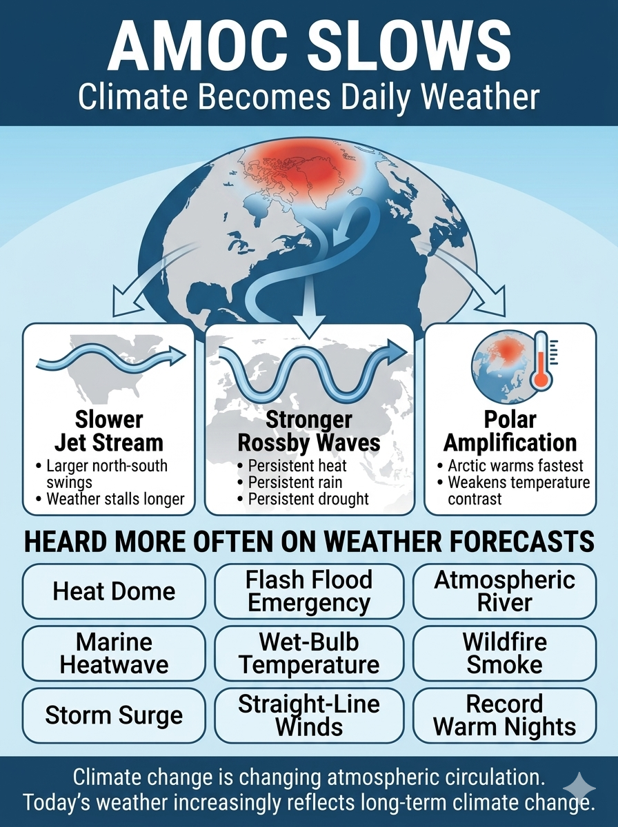
- Polar Amplification
- Pyrocumulus Cloud
- Pyrocumulonimbus (PyroCb)
- Rain-on-Snow Event
- Red Flag Warning
- Ridge Pattern
- Rossby Waves
- Severe Thunderstorm Warning
- Straight Line Winds
- Storm Surge
- Supercell Thunderstorm
- Surface Temperature Anomaly
- Tidal Flooding
- Tornado Emergency
- Tropical Disturbance
- Tropical Wave
- Urban Heat Island
- Wet-Bulb Temperature
- Wildfire Smoke Advisory
- Wind Chill
- Winter Storm Warning
Many of these terms were once used almost exclusively by atmospheric scientists and emergency managers. Today, they appear regularly in weather broadcasts because the atmosphere is producing more persistent, energetic, and complex weather systems. As climate change continues to reshape Earth’s weather patterns, the public is becoming fluent in a vocabulary that previous generations rarely encountered.