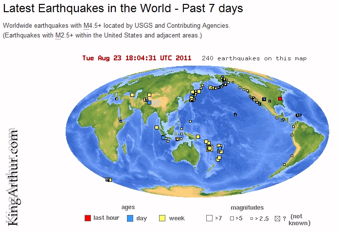
Magnitude 5.9 – VIRGINIA
2011 August 23 17:51:03 UTC

Earthquake Details
This event has been reviewed by a seismologist.
Magnitude 5.9
Date-Time
Tuesday, August 23, 2011 at 17:51:03 UTC
Tuesday, August 23, 2011 at 01:51:03 PM at epicenter
Location 37.975°N, 77.969°W
Depth 1 km (~0.6 mile) (poorly constrained)
Region VIRGINIA
Distances
6 km (4 miles) SSE (152°) from Louisa, VA
6 km (4 miles) SW (236°) from Mineral, VA
26 km (16 miles) SE (133°) from Gordonsville, VA
66 km (41 miles) NW (318°) from Richmond, VA
134 km (83 miles) SW (219°) from Washington, DC
Location Uncertainty horizontal +/- 10.9 km (6.8 miles); depth +/- 7.4 km (4.6 miles)
Parameters NST=390, Nph=390, Dmin=57.9 km, Rmss=1.17 sec, Gp= 47°,
M-type=regional moment magnitude (Mw), Version=6
Source
Magnitude: USGS NEIC (WDCS-D)
Location: USGS NEIC (WDCS-D)
Event ID usc0005ild
Felt in West Chester, PA.